

One person $1080, 2 and more pax $990 each plus UWA (Uganda Wildlife Authority) gate entrance fee of $35 per day which is paid separately directly to UWA online. Price includes all porters, food (meals) and accommodation whilst in the mountain
Guides brief clients the before the trek at Trekkers Hostel.
The trek starts at Trekkers Hostel in Kyanjuki, Kilembe which is situated 1,450 meters above sea level and 12 kilometers from Kasese town. It is best to start the trek by 9 am but you can leave as late as 11am. You walk 2.2km to the UWA rangers post at 1,727 meters, which takes about one hour. Here you pay the gate entrance fee and the rangers brief you on the rules of the National Park
Start at Trekkers at 1,450 meters and sleep at Sine Hut at 2,596 meters being a height gain of 1,146 meters.
We start by walking up the valley floor through tall forest trees of the Afro Montane Forest Zone. This is a steady climb with multitudes of birds and a chance of seeing blue monkeys scampering off through the forest. At times visitors may see troupes of 15 to 20 black and white Colobus monkeys as they swing through the tree tops. There are rare sightings of the L’Hoest monkey which are part of the Bukonzo cultural emblems and are protected by the virtue of the King or Omusinga or you may hear wild chimpanzee in the distance. There is wide variety of plant species from forest trees to bamboos thickets, low shrubs, flowers, fungi, and with many moss and lichen covered vines hanging from the tall trees creating an awesome appeal. Enock’s Falls are just 200 meters from Sine Hut and offer a splendid opportunity to capture a great screensaver for your memories.
At Sine Camp 2,596 metres we have wooden huts set between tall forest trees on a narrow ridge where you may sit and enjoy the beauty of the Afro Montane forest while you look down at a fantastic waterfall crashing over the rocks far below. Some clients prefer to sit outside enjoying the warmth of the campfire and chat to the guides about the mountains and life in their community. Sine is just below the bamboo zone and the area around has many different bird species. 150 meters from the camp is Enock falls which is set in livid green vegetation and hanging vine. Truly beautiful. Sleep at Sine, or those who are fit and want to proceed to Kalama Camp at 3,134 metres may do so and apart from the fantastic views gives you more time at Mutinda Camp where you may climb up to Mutinda Lookout at 3,975 metres with great views
Start at Trekkers at 1,450 meters and sleep at Sine Hut at 2,596 meters being a height gain of 1,146 meters.
We start by walking up the valley floor through tall forest trees of the Afro Montane Forest Zone. This is a steady climb with multitudes of birds and a chance of seeing blue monkeys scampering off through the forest. At times visitors may see troupes of 15 to 20 black and white Colobus monkeys as they swing through the tree tops. There are rare sightings of the L’Hoest monkey which are part of the Bukonzo cultural emblems and are protected by the virtue of the King or Omusinga or you may hear wild chimpanzee in the distance. There is wide variety of plant species from forest trees to bamboos thickets, low shrubs, flowers, fungi, and with many moss and lichen covered vines hanging from the tall trees creating an awesome appeal. Enock’s Falls are just 200 meters from Sine Hut and offer a splendid opportunity to capture a great screensaver for your memories.
At Sine Camp 2,596 metres we have wooden huts set between tall forest trees on a narrow ridge where you may sit and enjoy the beauty of the Afro Montane forest while you look down at a fantastic waterfall crashing over the rocks far below. Some clients prefer to sit outside enjoying the warmth of the campfire and chat to the guides about the mountains and life in their community. Sine is just below the bamboo zone and the area around has many different bird species. 150 meters from the camp is Enock falls which is set in livid green vegetation and hanging vine. Truly beautiful. Sleep at Sine, or those who are fit and want to proceed to Kalama Camp at 3,134 metres may do so and apart from the fantastic views gives you more time at Mutinda Camp where you may climb up to Mutinda Lookout at 3,975 metres with great views.
After a good breakfast, trekking starts at 8.30am and you enter the Bamboo-Mimulopsis Zone which is steep climb with many high steps. In the wet season the bamboo zone is rather muddy and slippery making the going slow. However the atmosphere and the forest is beautiful as you climb 551 metres altitude and a distance of 1.8km to Kalalama Camp at 3,147 meters which is in the Heather-Rapanea Zone where you can take a rest and a quick cup of tea or coffee before heading on to Mutinda Camp. The trail meanders up and over several small knolls along a ridge top then drops down the side of the valley before climbing again, and in doing so cross several small streams and pass close to moss covered waterfalls. You then climb steadily along the side of a beautiful mossy river which tumbles down over the rocks under the Giant Heather trees whose trunks are covered in green moss with old man beards (Usnea lichen) hanging from the branches. The trail twists and turns as you climb up the deep valley, which has an enormous variety of plants and flowers. This valley is unique with many Giant Heather trees creating a beautiful atmosphere often shrouded in mist.
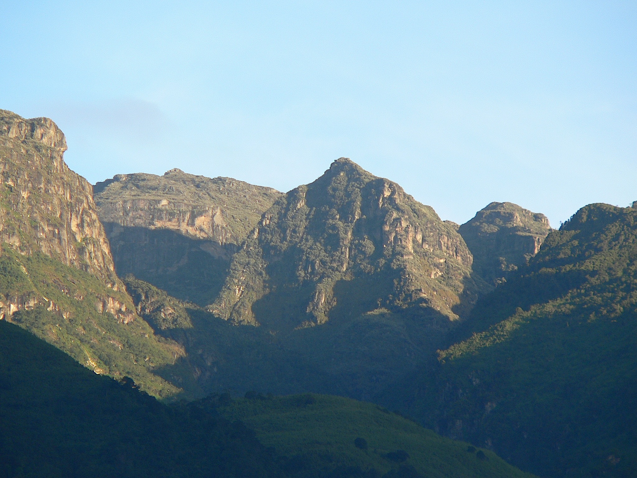
In the afternoon you may wish to climb up to the top of the Mutinda Lookout (one to two hours up and one hour down) The views are amazing as you stand on moss covered rocks at 3,925 meters with views across the Rwenzori Mountains and down to Kasese town and Lake George. For those clients who are climbing to Margherita or any of the main peaks climbing Mutinda 3,975 meters is also an excellent way to acclimatise and reduce the risk of high altitude sickness.
4.9km starting at 3,688 meters climbing to 4,062 meters
The trail here is boggy particularly in the wet season but with a little skill you can step from tussock to tussock to make the going easier. We have put several boardwalks across the worst of the bogs and continuing to build more to make it a little bit easier. You cross the Mutinda valley through the tussock grass and everlasting flowers interspersed with many Giant Lobelias before climbing a steep section up to the Namusangi Valley (3,840 meters), which ends abruptly with sheer waterfalls and fantastic views of Mutinda Peaks. The Namusangi Valley is wide, with many ups and downs and crossing several bogs as the trail climbs steadily to Bugata Camp at 4,062 meters. Bugata Camp is situated way up Bamwanjara Pass high above Bugata Lake with views across Lake Kopello to Weismann’s Peak, which is often covered with snow then down the valley views of Lake Africa and Lake Kanganyika and the many small peaks towards Mutinda Camp. The area is covered with tussock grass, everlasting flowers (Helichrysum), St John’s Wort (Hypericum becquaeritii), giant groundsel (Senecio adnivalis) and Giant lobelia (Lobellia gibberoa). There are a many Red Forest Duiker (Cephalophuc nigrifrons rubidus) which are a sub-species only found in the Rwenzori Mountains.
Bugata Camp has good facilities, solar lights, good toilets and bathrooms where the guides may prepare some warm water in a basin for you to wash. Bugata also has a helicopter pad (GPS reading N 18.312 E29 53.457) in case of any need for rescue by helicopter but be warned that a helicopter in Uganda costs around $10,000 per hour flying time which is way more than other countries so you need insurance in case of rescue.
Climb Weismann’s Peak 4,620 metres and Stella Peak 4,626 metres 3.7km to Weismanns Peak then another 800 metres to Stella Peak and return. Total distance 9km 4 to 6 hours. The trek starts by walking across the hillside below high cliffs above Bugata Lake then around a ridge point to Lake Kopello where we walk along the edge of the lake which according to researchers the water temperature averages 2˚C As you climbing you get excellent views of the four lakes along the valley below. The last section to the peak is steep on solid rock and can be difficult when snowing or iced up and it may be necessary to use ropes for safety. On a clear day you get awesome views of all the main peaks, Mt Stanley, Mt Speke and Mt Baker. The top of Weismann’s Peak is relativity flat or dome shaped with deep moss growing on the rocks creating a beautiful atmosphere. Stella Peak 4,626 metre is near Weismann’s but needs full technical as is dangerous and needs experience and a good head for heights. We do not advise crossing to Stella Peak
From the peak we descend directly to Kiharo Camp 3,460 metres down the Nyamwamba Valley. At the head of the valley there is a large area of thick Giant Groundsel with dense evergreen undergrowth and moss with the rocky peaks towering above which creates it’s own micro environment. As you descend the valley you will notice the terrain is made up of several flat boggy areas where millions of years ago glaciers sat and melted leaving a wall of big rocks in front of where it lay. The valley is home to many Red Forest Duiker (Cephalophuc nigrifrons rubidus) At night you may stay in Kiharo Camp at 3,460 metres an area rich in evergreen plants and babbling streams. Particularly during the dryer months the night the air is filled with the calls of the rock hyrax as they sit in the rocky cliffs high above.
Distance Kiharo Camp to the park gate 16km and another 2.8km down to Trekkers Hostel. Time to walk 5 to 8 hours so those who need to connect to flights back to Kampala or travel on to other activities need to leave Kiharo early.
The trail down the Nyamwamba Valley is mostly downhill and absolutely stunning with beautiful views, moss covered rocks along the river, cascading waterfalls, deep valleys and forests are possibly the best in the Rwenzori Mountains. This part of the trail took us six years to find a way through and a route which is easy enough for tourists to use. In 1937 the explorer and geologist McConnell tried to find a way up this valley but failed and have to turn back and search for another route up the mountain but now you can experience this truly beautiful valley.
A few kilometres from Kiharo Camp the path turns off to the right to pass along the river. In the clear areas you may catch a glimpse of a Duiker quietly feeding in small clearings as you pass along the river. This area is possible the highest population of Rwenzori Red Duikers anywhere in the National Park A few kilometres down the river it becomes steeper with multitudes of stunning waterfalls. After the waterfalls we climb up and over a high ridge then down though the dense forests with stunning views of the valley below. We stop at Forest View Camp for lunch before proceeding back to Base Camp. A great experience and ending to a fantastic trek.


Trekking Rwenzori Mountains is a truly fantastic and unique experience
Kilembe Office
(Rwenzori Mts)
Operations Manager (Brian)
Tel: +256 (0) 774199022